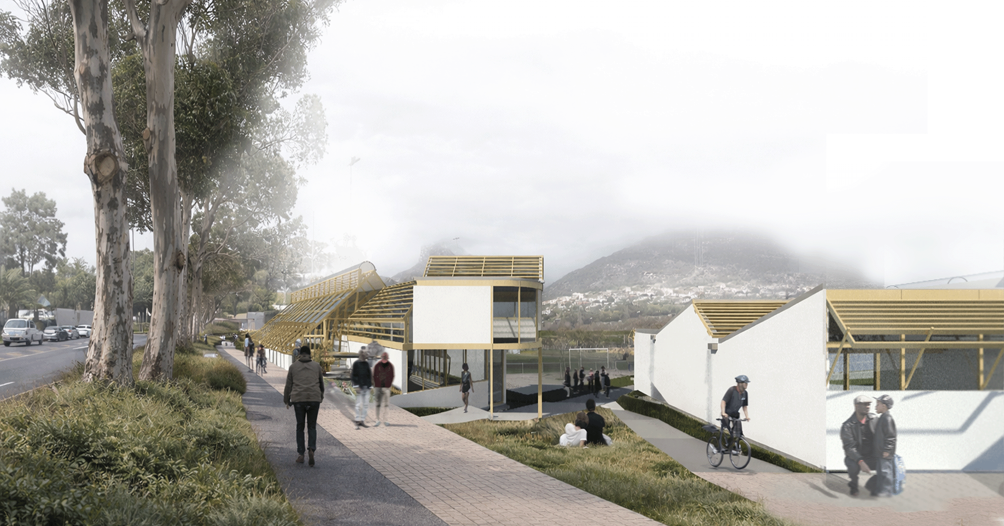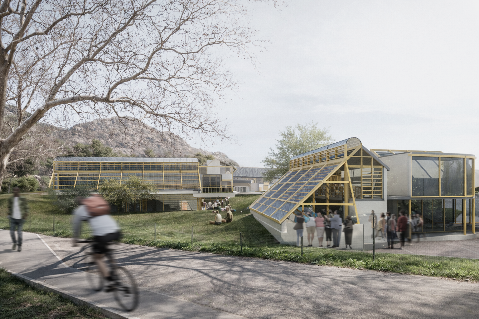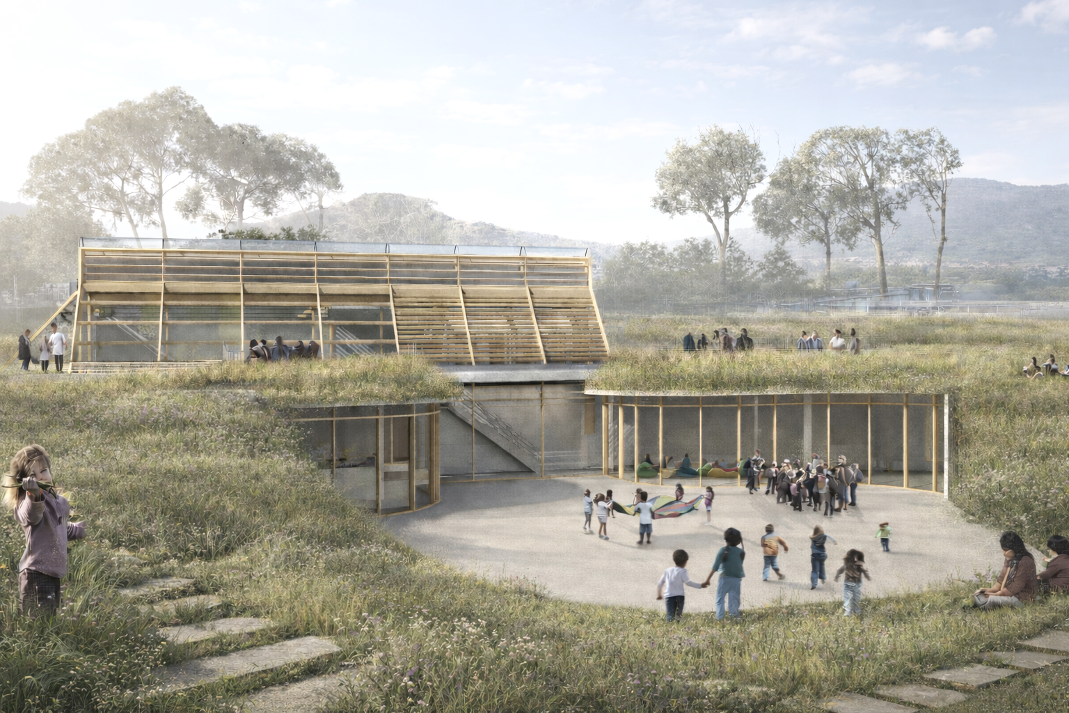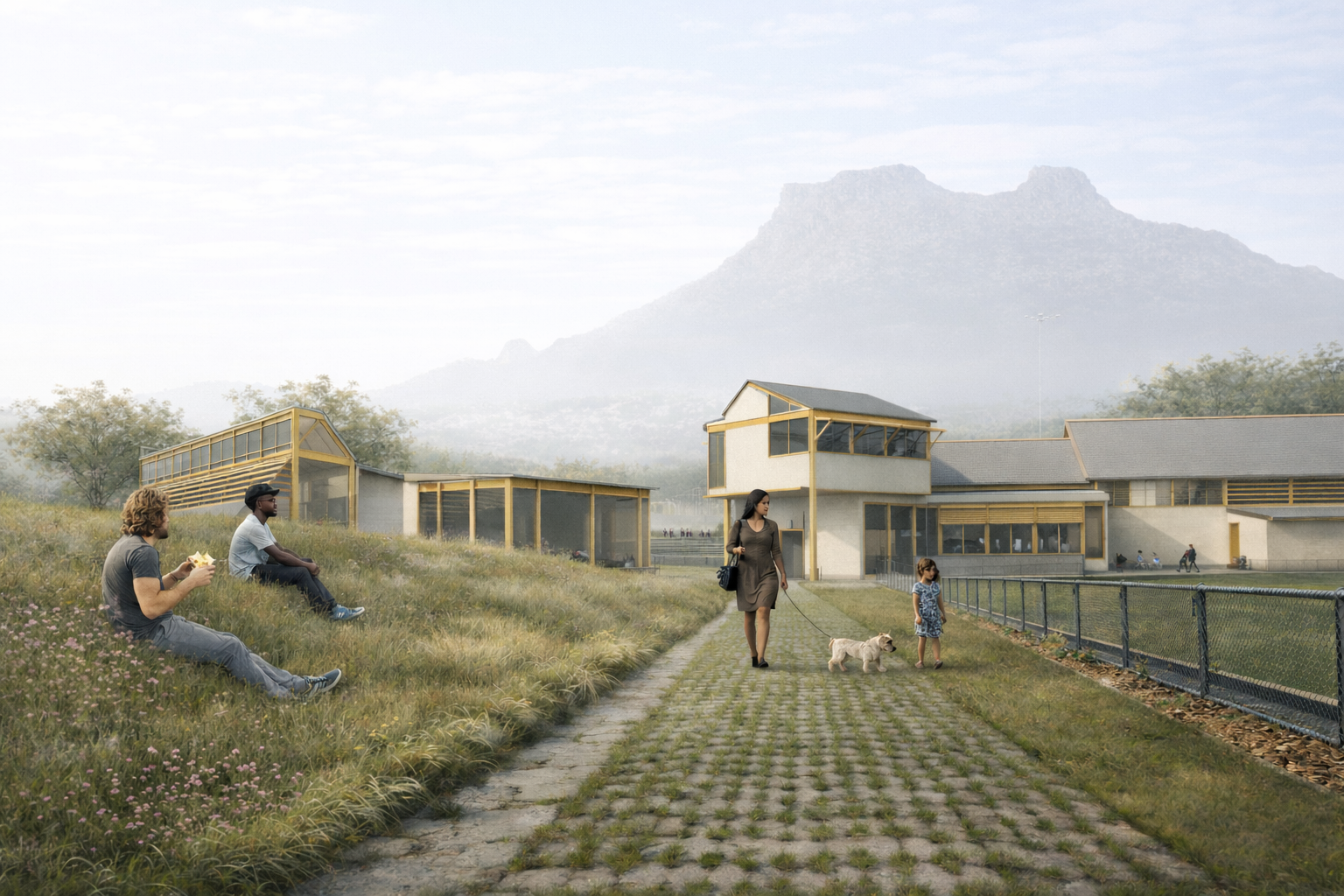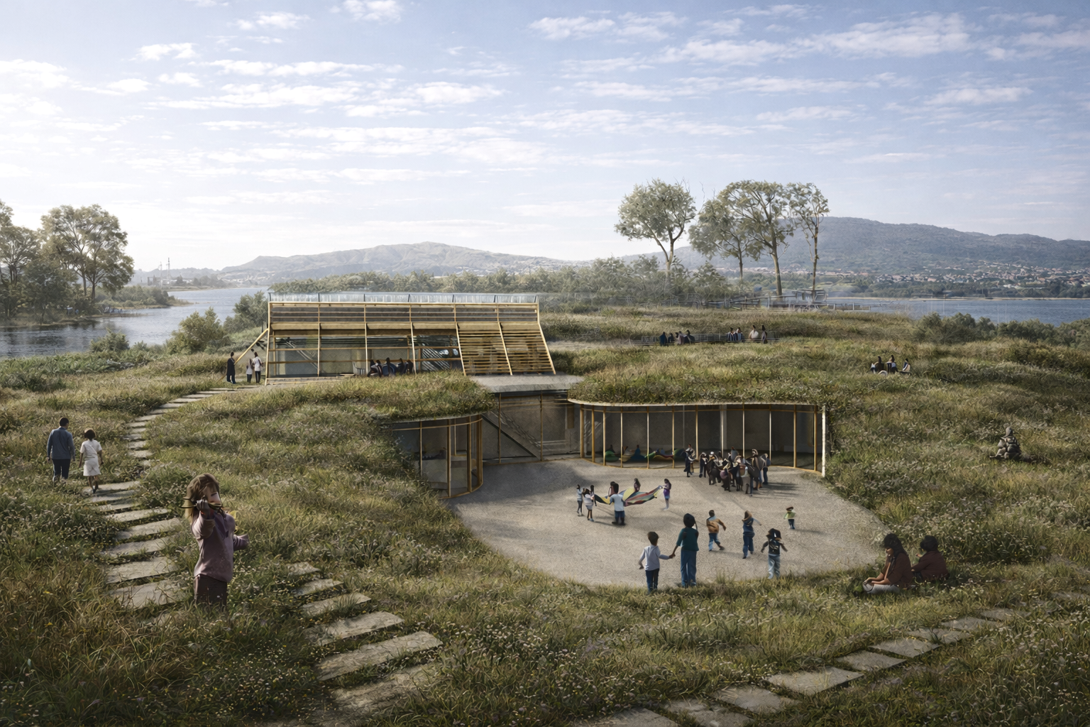
Design Initiative: Rooted in intersectional environmentalism, IY Interface reimagines the Disa Valley as rehabilitated, accessible landscape. The design emerges from community-led research on environmental degradation. Low-tech interventions create safe spaces for learning, play, food production, and spaza shops.
IY.Interface
Location: Imizamo Yethu, Cape Town, South Africa
Program: Early Childhood Development Centre, Farm, Market
Level: BAS Hons semester 1
Supervisor: Michael Louw (michael.louw@uct.ac.za)
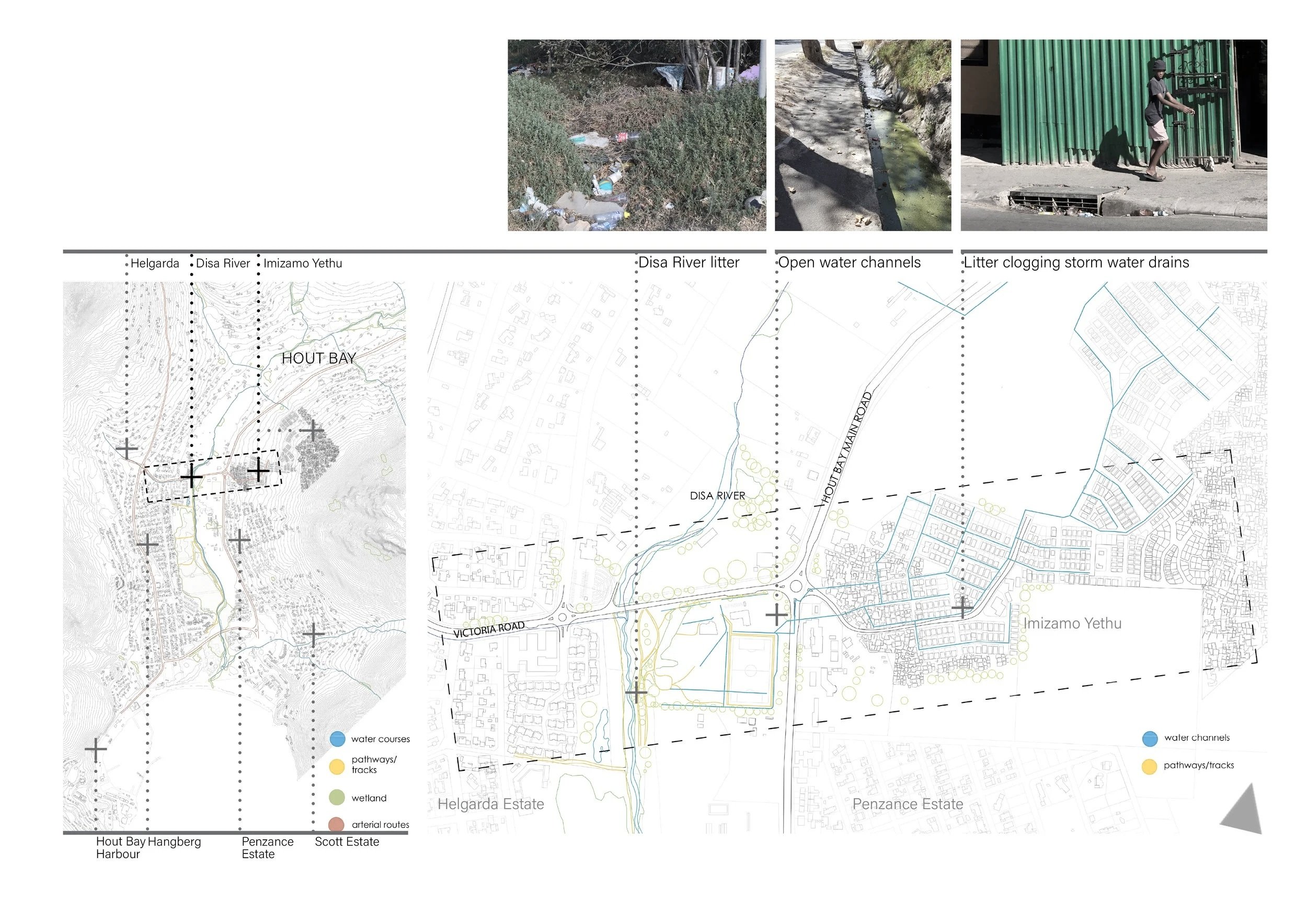
Site Context: Imizamo Yethu is a low-income township in Hout Bay, Cape Town, built on the mountain slopes within the Disa River Valley. The valley forms a riparian and wetland system that extends from Table Mountain to the estuary. The project site is located at the interface between affluent suburbs and the township.
Existing Conditions: The settlement lacks adequate water and sanitation infrastructure. The service ratio is critically low: 394 households per tap. Heavy rainfall overwhelms existing stormwater and sewage systems, forcing contaminated water into homes and streets.
Untreated discharge flows directly into the estuary and ocean. The ecosystem is extremely damaged due to inadequate infrastructure, overcrowding, water pollution, invasive alien species, and the unsafe conditions that make it difficult to access the river banks.
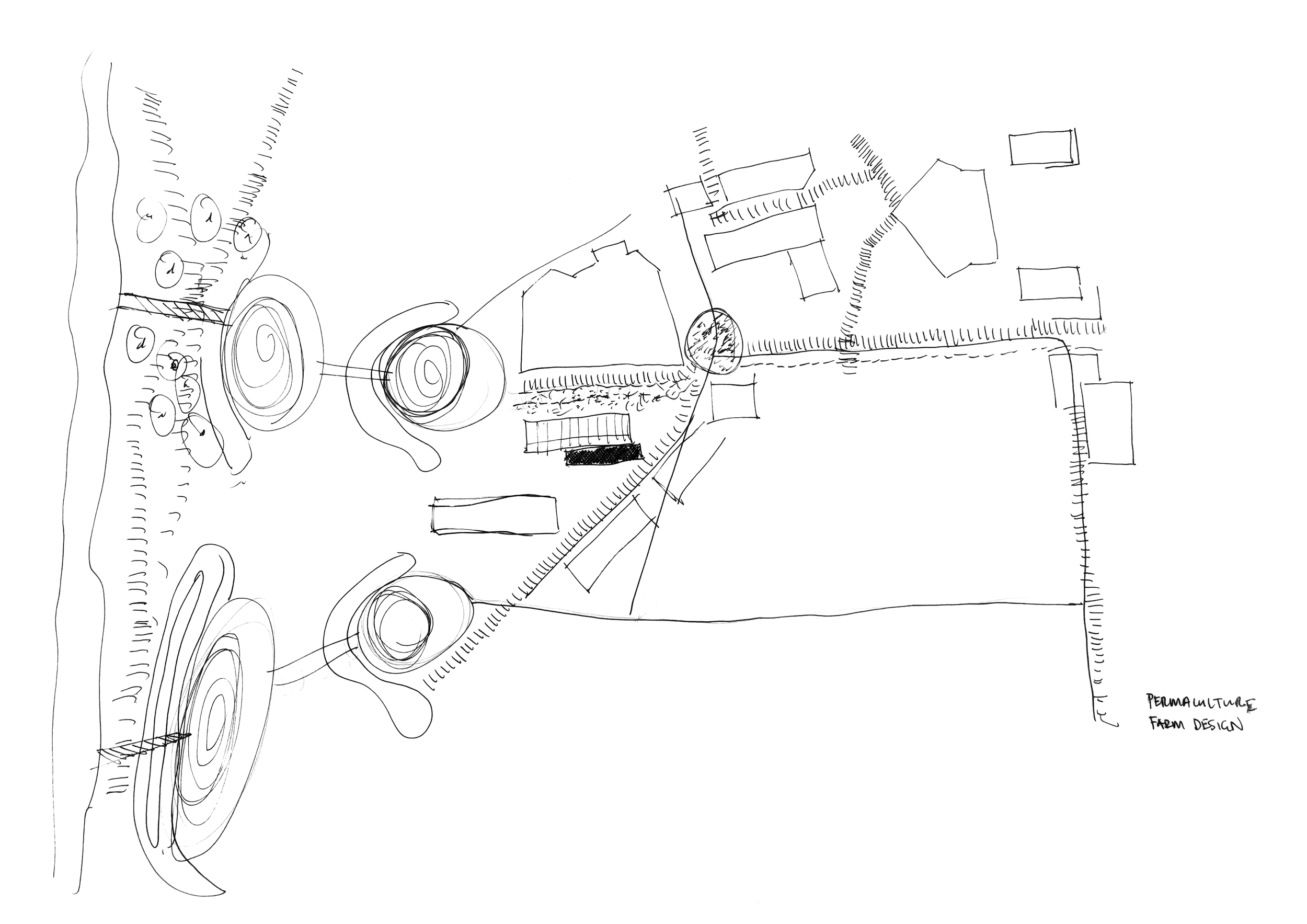
Mapping and Research
Mapping physical infrastructural elements such as existing storm water channels, wetland areas, pedestrian pathways. These elements directly affect the quality of life of residents by compromising hygeine health and safety.
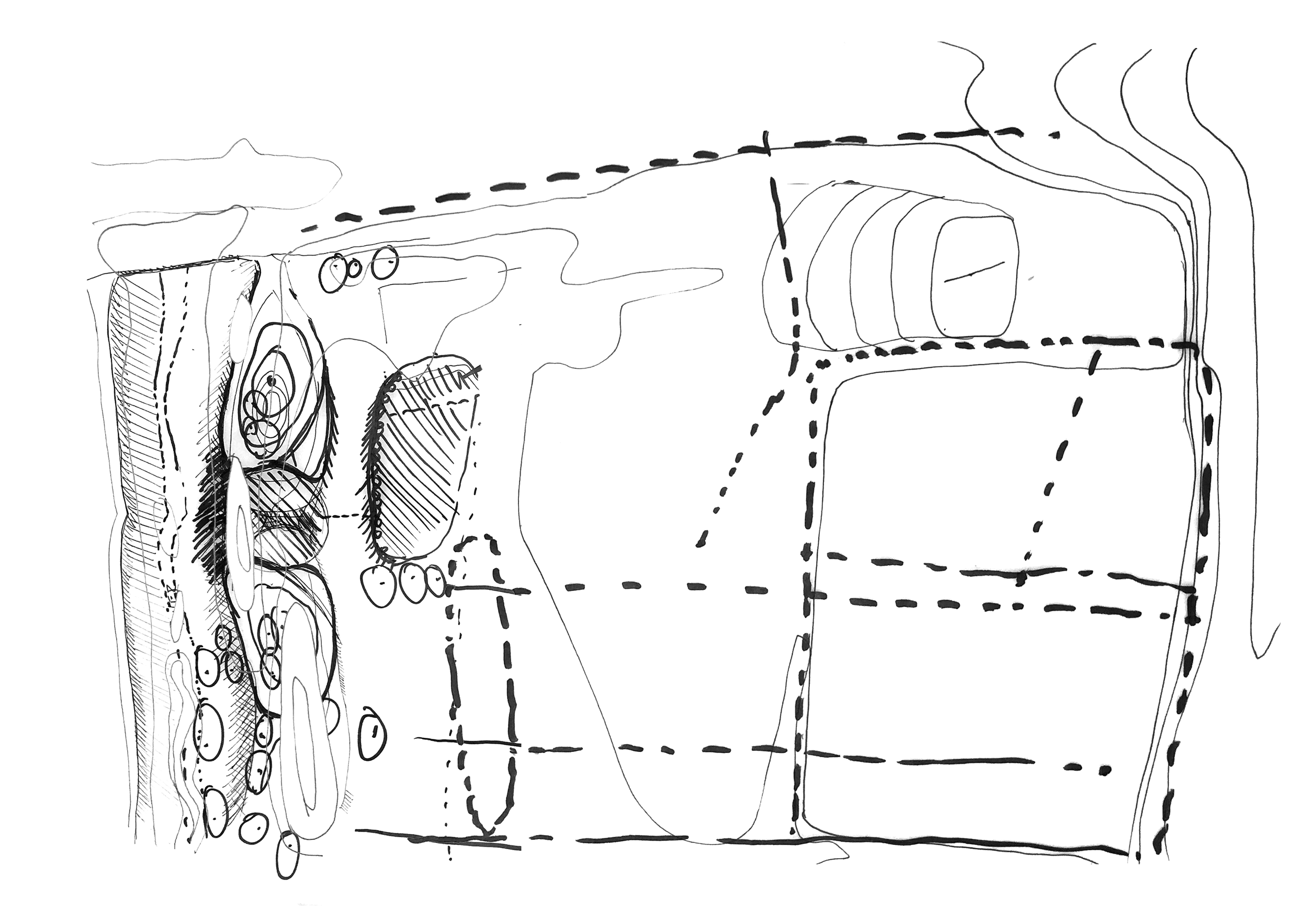
Transects
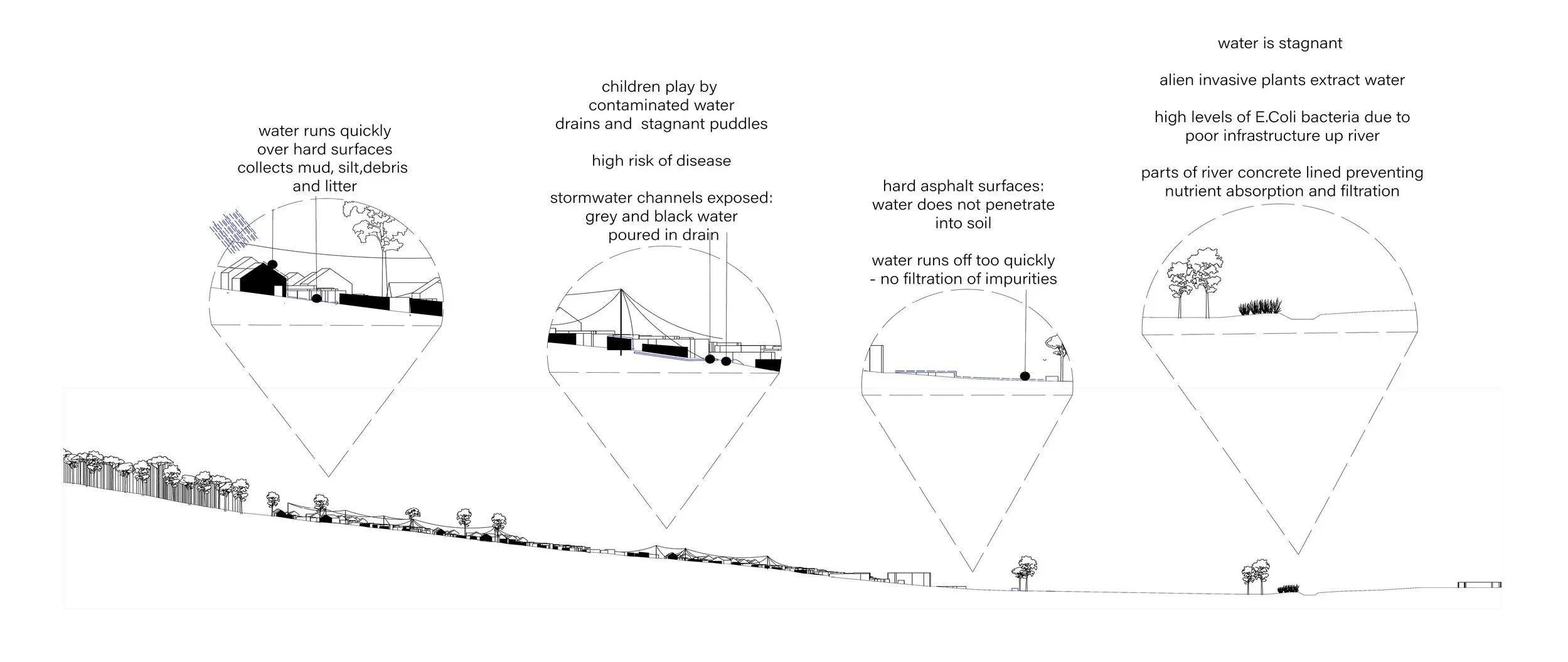
The transect visualizes the current environmental performance of the site, highlighting rapid runoff, exposed stormwater channels, stagnant contaminated water, and a hardened river edge. By reading the landscape as a connected system, the drawing identifies critical points of failure and sets the foundation for ecological restoration and infrastructure intervention.
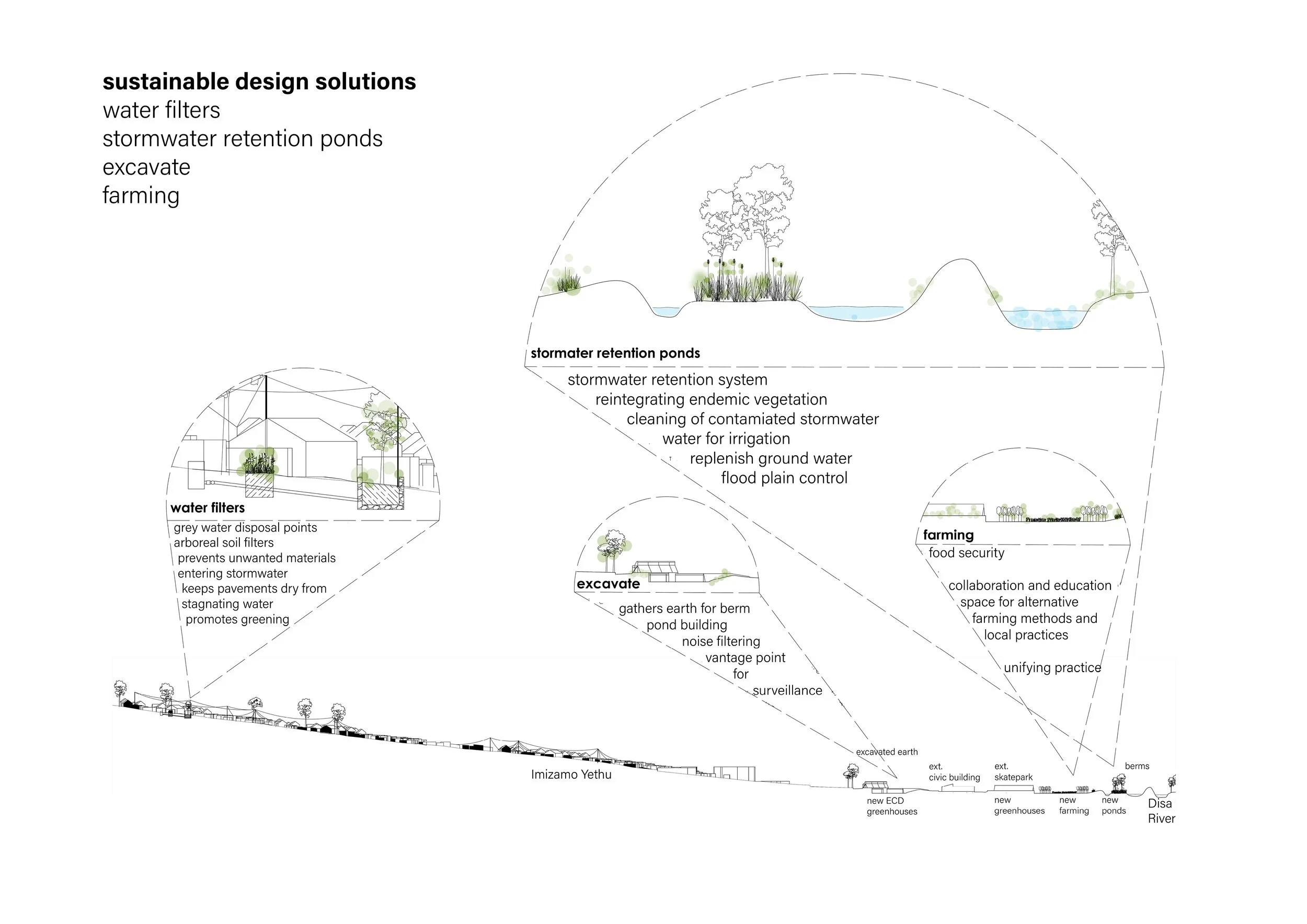
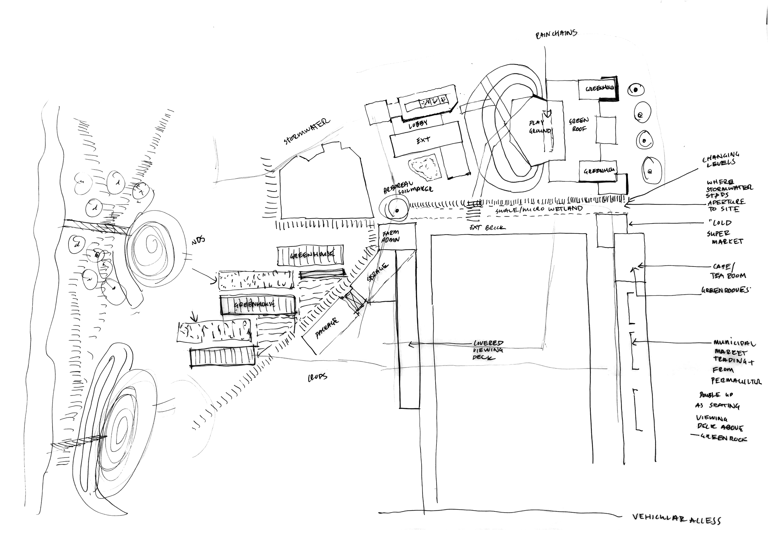
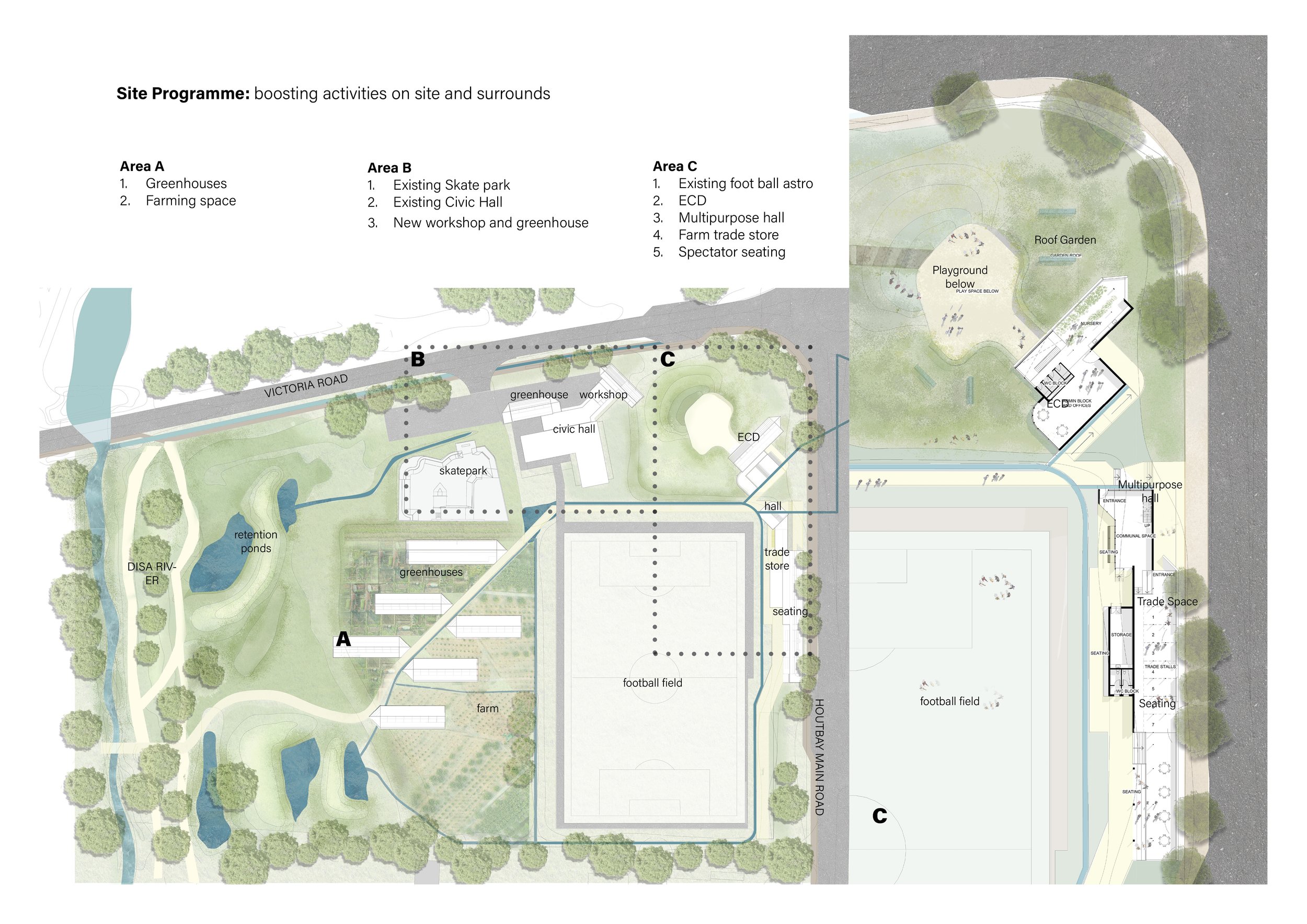
Site Program
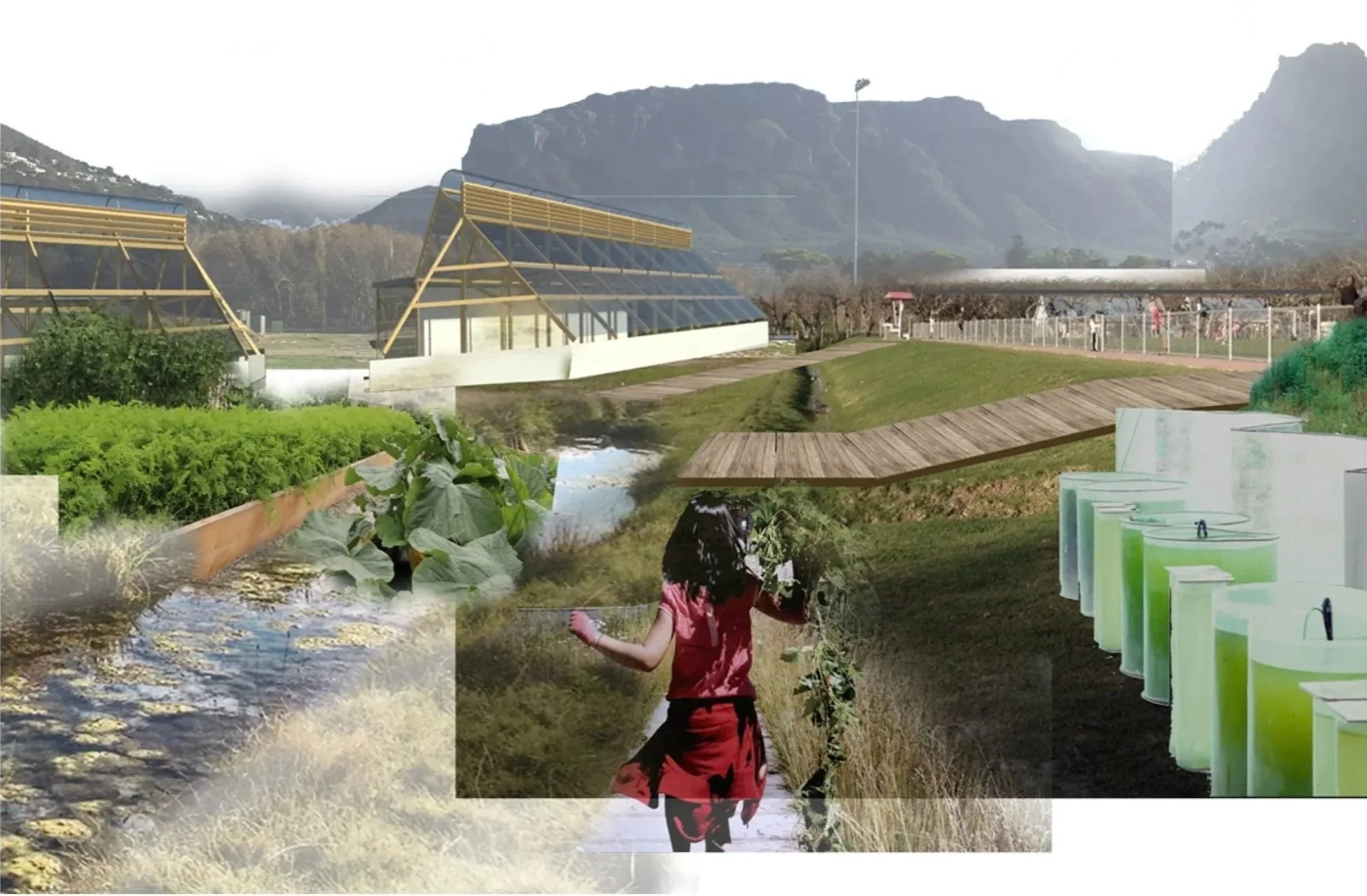
The plan organizes itself around the site's water infrastructure. New channels follow existing stormwater drainage routes, with circulation paths running alongside. Retention ponds punctuate the landscape, and between these systems, the site's activities unfold—creating an integrated urban ecosystem.
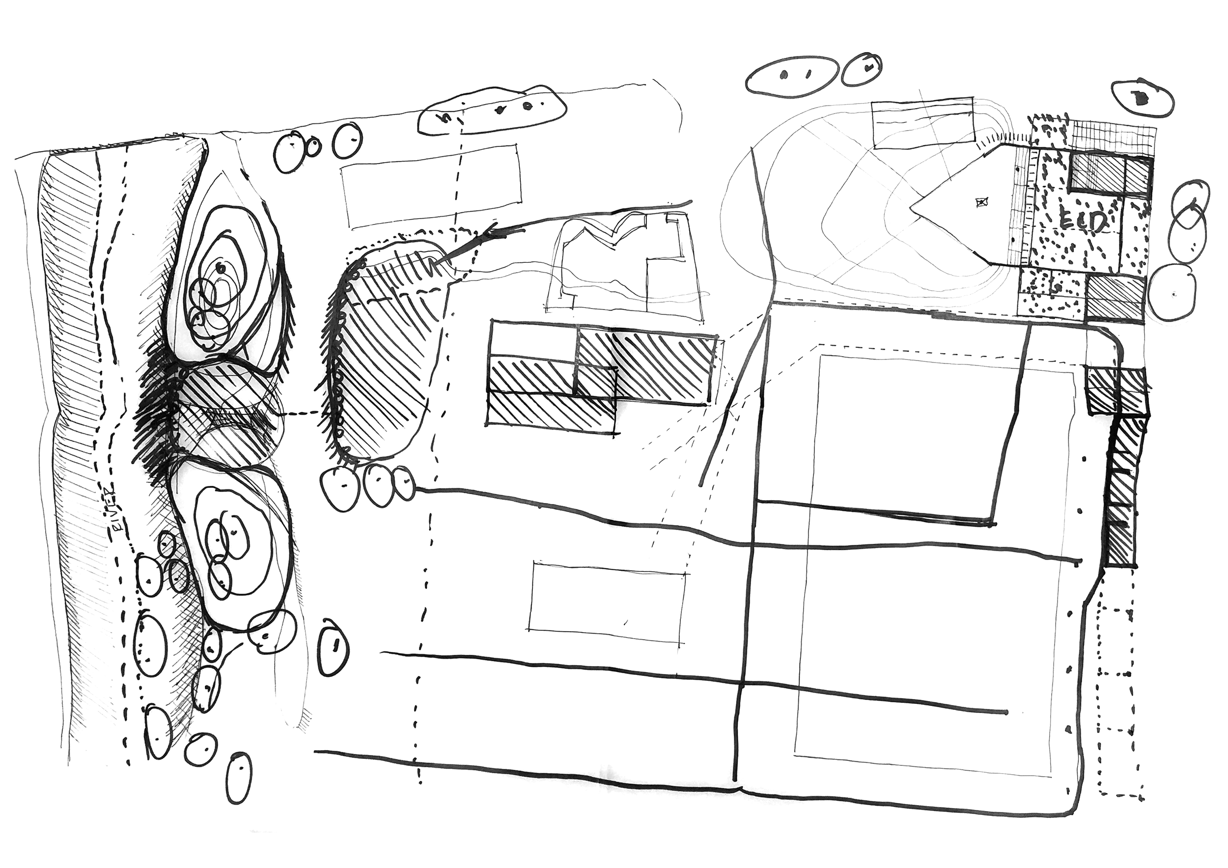
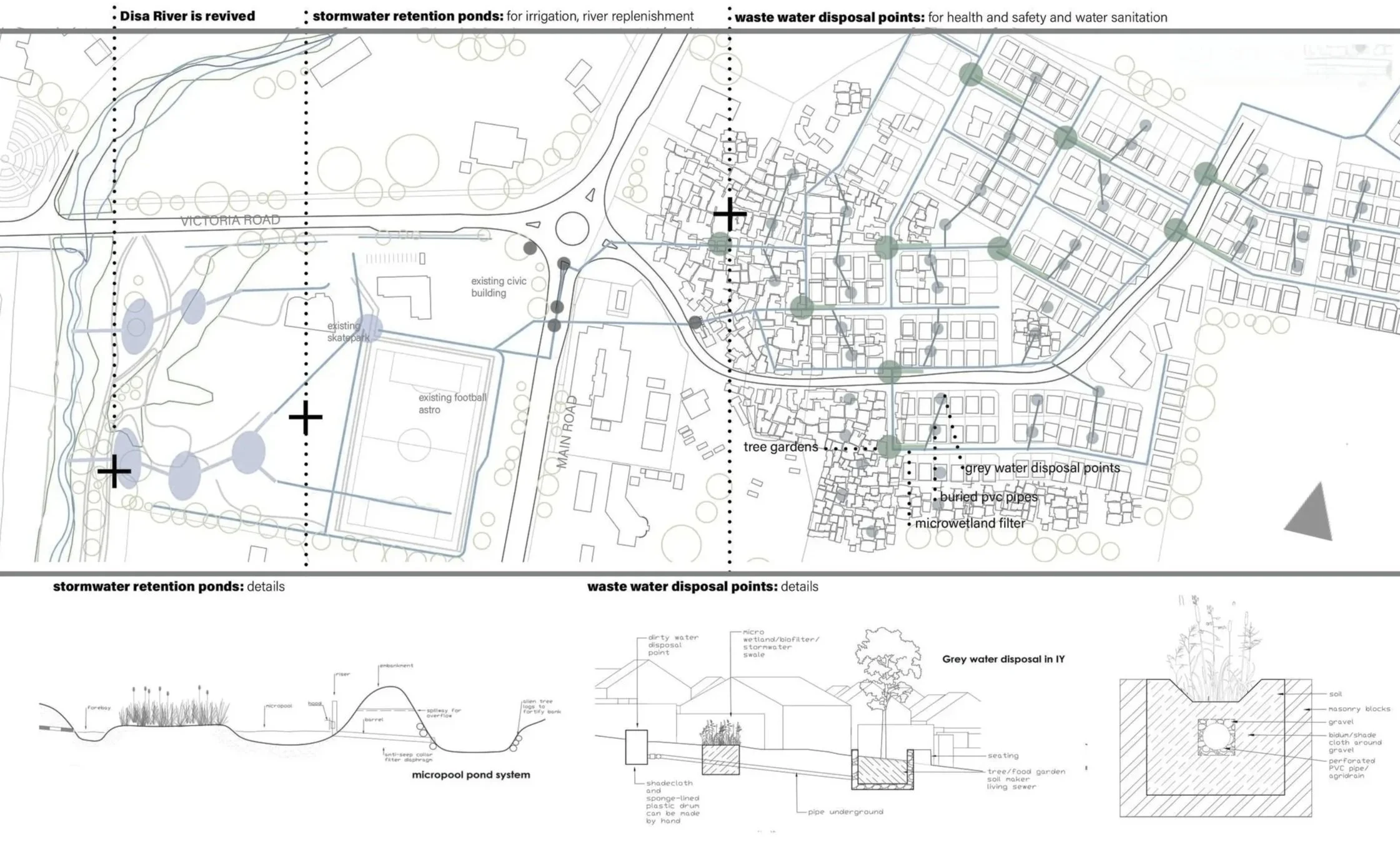
Infrastructure Plan
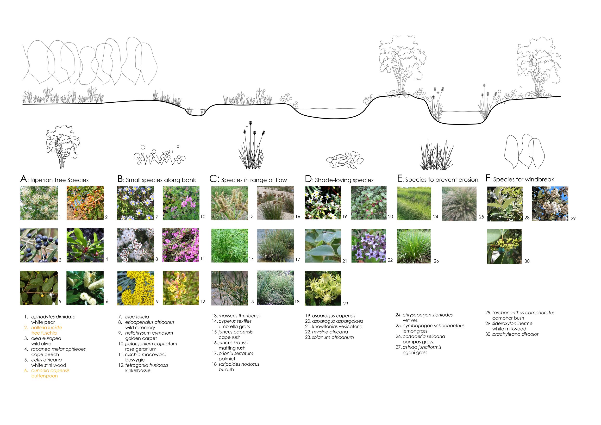
Indigenous Planting Plan for River Bed Rehabilitation
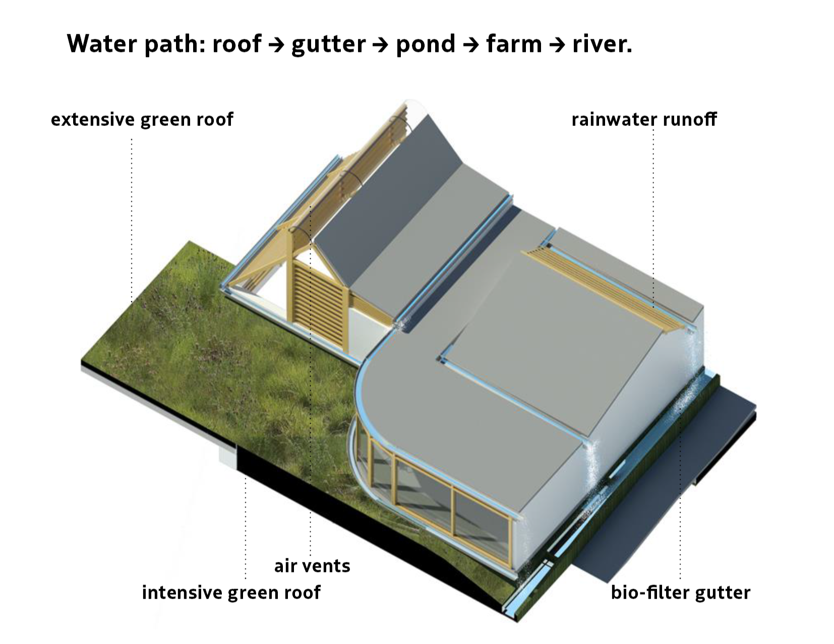
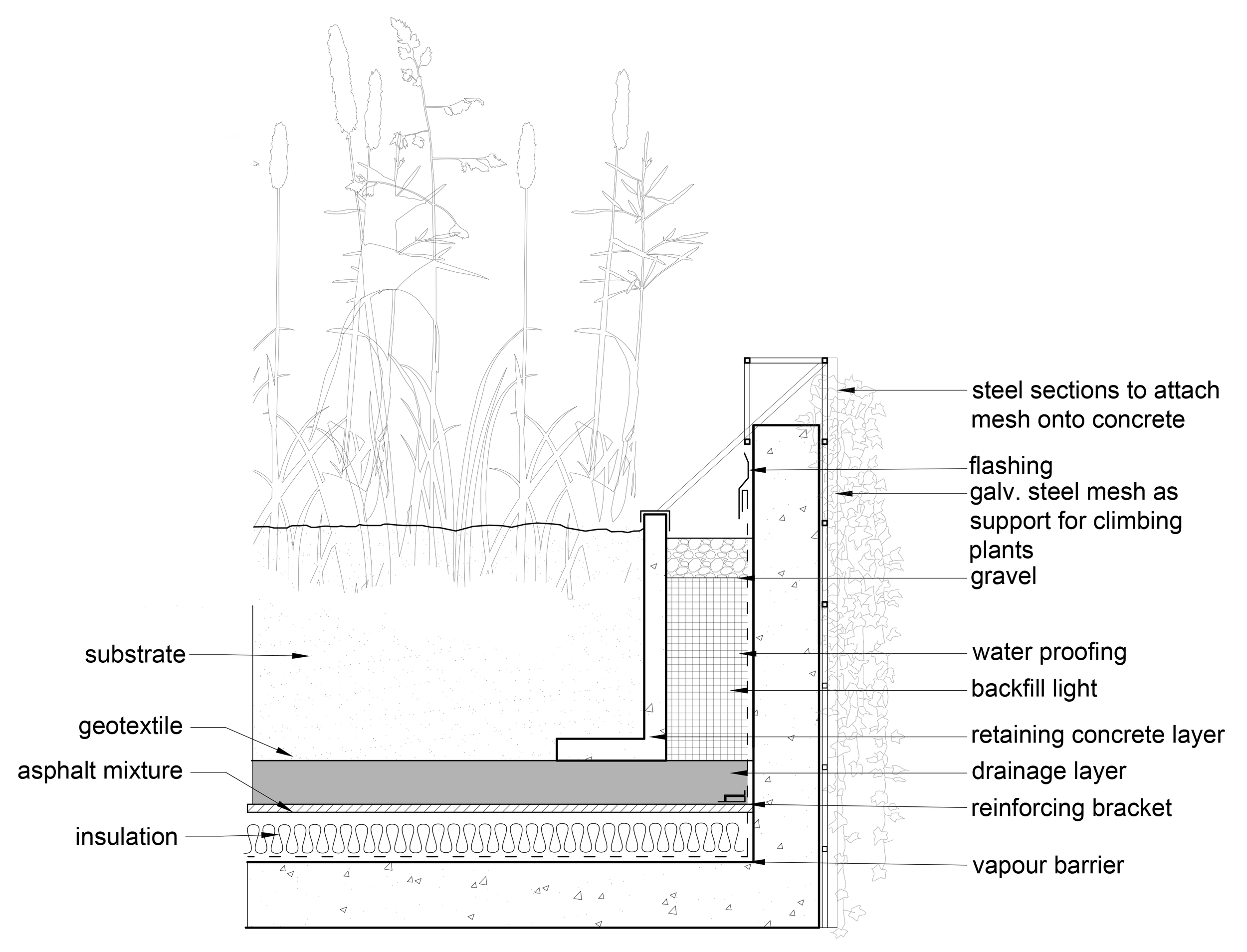
Extensive green roof at the slab edge:
substrate over geotextile and drainage layer on the waterproofed slab. Climbing plants grow over the steel mesh, blending roof into ground
Green Roof:
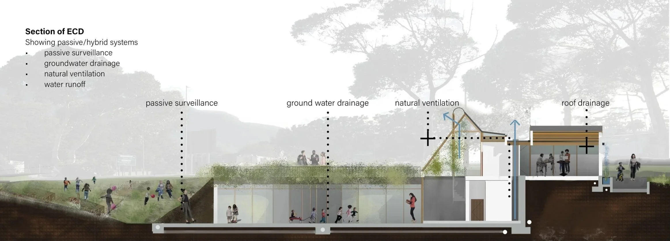
The green roof combines two build-ups, separated by railings: an intensive roof at the playground areas, planted and trafficable, and an extensive roof at the slab edges, where walking is not permitted (see detail).
Roof Drainage:
Rainwater runs off the pitched roofs to open spouts and falls into the planted biofilter gutters below. The planting filters sediment and takes up nutrients as the water passes to the retention ponds; from the ponds it irrigates the farm and returns to the river.
Biofilter gutter at the building edge:
planting bed over gravel and perforated pipe, between cavity wall and kerb.